


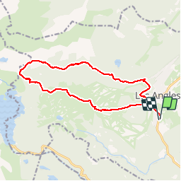

13.3 km | 19.3 km-effort


User


FREE GPS app for hiking
 SityTrail
IGN / Geographical institutes
SityTrail World
The world is yours!
Trail Walking of 17.2 km to be discovered at Occitania, Pyrénées-Orientales, Les Angles. This trail is proposed by Axelloceane.
Départ de la station des angles et retour par télécabine

Walking

Snowshoes
Walking

Walking

Walking

Walking
Walking

Nordic walking

Snowshoes
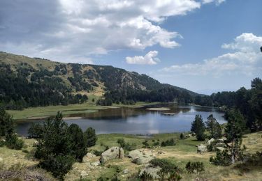
tres belle rando
tres bonne rando, agreable